If you haven’t fished Kentucky Lake, then some of these pictures won’t make as much sense as they do to those of us that fish it regularly. I spent a couple hours during lunch yesterday driving around to various locations to document the flooding. The lake has never been this high and may not be this high again for some time.
The previous record height for the lake was 369.99 set in 1984. Yesterday, the lake was at 372.9. Today, the lake is at 373.5, and we hope that will be the crest. That puts the lake 14 1/2 feet over the summer pool level and 19 1/2 feet over the winter pool level. In some areas a 10-foot rise upward meant a 100-foot encroachment of water onto parking lots, tennis courts, campgrounds and yards around the lake.
There are a lot of people still fishing, though. We’re not in that party as we’re not going to risk tearing up our boats to launch and run over stuff submerged now. But the force of water is something to behold and appreciate. Here is a look at the lake at its record water levels.
CLICK PHOTOS to ENLARGE
The Kentucky Lake Dam was blowing and going yesterday and still the waters rose from four solid days of rain.
A shot of the flows from today at nearly 15 feet above normal levels.

Cumberland River flows seemed even more violent with 4 foot waves bouncing back and forth in the canal below Barkley Lake.

A lot of equipment was flooded when the Tennessee River below Kentucky Lake rose so fast.

Mark Menendez and I launched here last fall for a photo shoot. We parked our rigs by the last light pole on the left and launched down a steep hill about 100 feet further to the left from there.

Normally one of the busiest ramps on the lake, the Ky Dam Marina Ramp is at least 100 feet out in the water. This is the “upper road” at the ramp. I believe there are three rows of trailer parking spaces under water here.

At about the point of the trees on the left is where FLW Outdoors had the stage for the Jet-A-Marina weigh-in two Saturdays ago. We’d be able to weigh from our boats today.

Normally that sign sits on a hill above where we take our boats out and strap them down before hauling back to the house after a long day of fishing.

This bridge is normally on top of a 10-foot tall rock wall that separates the Paddle Boat area of Ky Dam Marina from the rest of the lake. The rock wall is wide enough to drive a golf cart on and on a normal day, you can’t see over the wall into the lake.

Don’t think the kids will be enjoying the playground at Moor’s Campground and Marina for a bit.

No putt putt for a while either, although apparently it makes for good sailboat parking. The Ark is rather appropriate. I know where I’m headed if the water goes any higher!

The Moor’s Marina Dock is a ferry ride away now. Normally you can launch and just walk down the ramp there. Now the best launch appears to be off the side of the parking and turn around road.

The old back ramp at Moor’s where most of us launch for the infamous Tuesday Night Jackpots is a little hard to launch from right now too. Watch out for the fun noodles in the distance. That’s where Moor’s old rip rap wall is hiding now.

Supposedly there is a BWS going out of Moor’s Saturday. By our estimation there is parking for about 10 boats and trucks right now. But the lake could come down a whole bunch by then. Who knows.

I launch out of Big Bear often when fishing the North end of Kentucky Lake. This is the large picnic pavillion at the ramp area.
There are a bunch of picnic tables out to the left of it. That could be a good pattern now I suppose. That or flipping swing posts.

Might want to launch with a buddy, or wear your floaties. It’s a bit of a swim to the tie up. That bridge is normally 5 or 6 feet off the water.

Normally this is a very steep walk down a hill to the dock. Now it looks like an uphill swim at the Ken Lake Dock.

You should be looking at a massive rock wall that protects KenLake Marina. Unfortunately it’s just under the surface now, perfect for removing that old pesky lower unit you’ve been wanting to replace.

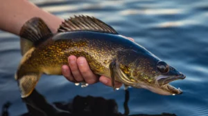
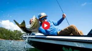
Despite all this, there is plenty of fishing to be had. Just have to navigate passed a few docks, rip rap walls, parking lots, picnic tables and around the tennis court, and you’re good to go.

Good parking and bank fishing access for everyone at Kentucky Lake right now. Everyone can get a good spot. Bank fishermen have been out in droves this week. I even saw a few nice bluegills caught on my photo adventure.