
If you want to read about many of the intricacies regarding finding offshore bass and locating large schools of bass with your electronics… I’m honestly probably not the best person to ask around here. Several of the other Wired2fish guys would be able to point you in a more solid direction. We have some crazy-good electronics guys on our staff.
But I do know one thing. I know that when I was younger, I couldn’t afford fancy electronics. I was dirt poor and I always had hand-me-down units on my boat that I bought from my fishing buddies. While we’d all be at supper, I’d listen while they clamored about their new electronics and all the cool fishing spots they had found with them.
All I could do was listen because Lord knows I couldn’t afford to put that stuff on my boat. But by gosh… those years of listening did me a lot of good.
When I’d get back to my tiny college apartment, I’d pull up all kinds of satellite imagery on my ragged old laptop and try to find any type of structure I could. I was never looking for their spots because I knew I wouldn’t learn anyting by doing that. But I learned the type of areas they looked for and without emptying my already-barren bank account, I found some incredible fishing spots without even getting on the water. All it took was a lot of computer research.
I’ve been tinkering around lately with onXmaps. I’ve used this system for quite some time during hunting season but the more I’ve experimented with it, the more I’ve found it useful for my bass fishing endeavors as well. This made me think back to my college days and my always-limited budget, so I wanted to see how much it could help our readers as well.
I signed up for a free, seven-day trial. All I did was enter my email address and a password. There was no long sign-up form and I haven’t received a single spam (or any) email from them yet. But check out some of the places I’ve found. I’ve caught fish on each of these places and I found ’em in about 30 minutes of looking around onXmaps from the comfort of my office.
Ditches you never knew existed
I have fished my home lakes for a long time and honestly, I feel like there’s not much you can show me that will surprise me. After playing around with onXmaps for… I don’t know… maybe 20 minutes, I found some of the most productive ditches I’ve ever found on my local lakes.
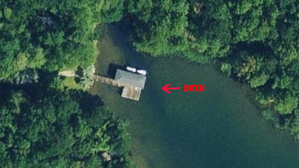
When using satellite imagery, ditches are represented by darker colors which, of course, represents deeper water. So whenever I’m looking at a shallow, light-colored flat on satellite imagery, I’m always keeping a close eye out for these darker-colored ditches. These often-small depth changes can make for an enormous feeding opportunity for big bass. The bass will often hide in these ditches and attack prey as it swims overhead. These ditches are perfect ambush points for fat and lazy bass.
Sure enough, in front of one of my favorite docks on my favorite lakes, I noticed a ditch running nearly parallel to the front of the boat dock. I have always had a lot of short strikes about halfway to the boat when fishing this particular dock. I figured it was just finicky fish or something but heck… I think they’ve been sitting in that ditch trying to ambush prey and of course, my boat has been sitting too close to ’em.
Yes, I have electronics on my boat but my contour maps haven’t picked up this small ditch because it’s so diminutive. I’ve even looked at it on my 2D sonar and it’s only a 3- to 4-inch depth change, so it’s nothing that would really pique my interest as I’m casually fishing along. But on satellite mapping, it stands out like a sore thumb.
Mud lines and water color changes
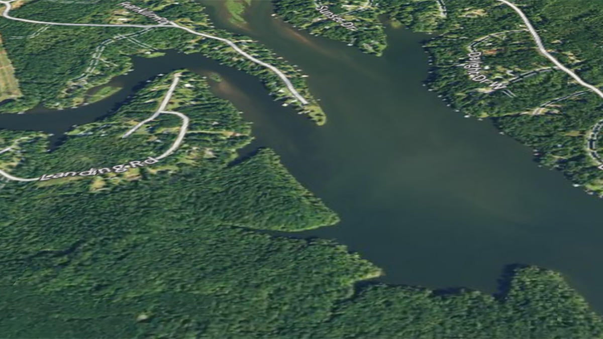
I totally understand that water color can change on a daily basis, especially during rainy periods and satellite imagery only gives us a small snapshot of our favorite fisheries. But over the years, I’ve learned that satellite imagery does, indeed, give us a good idea of where water color is most likely to change first.
I’m a shallow-water guy. I like to pitch a jig and throw some sort of a frog in the dirtiest water I can find. So whenever I’m researching a new lake or even my home lakes using satellite imagery, I’m trying to find the dirtiest water possible. Even if the images were taken in low-rain periods, you can normally still see slight water color changes that will become even more pronounced as precipitation increases.
I’ve actually been shocked by how two different river arms in the same lake can have such different water color. Of course, I’d prefer to go up a river and stay shallow. As I’ve studied onXmaps and scrolled around some of the different river arms, it’s crazy how some areas seem to get muddier than others.
They always say that shallow-water guys don’t need electronics. We may not always need ’em on our boats but by gosh, taking a few minutes to check out these maps on your phone or laptop sure can make a difference.
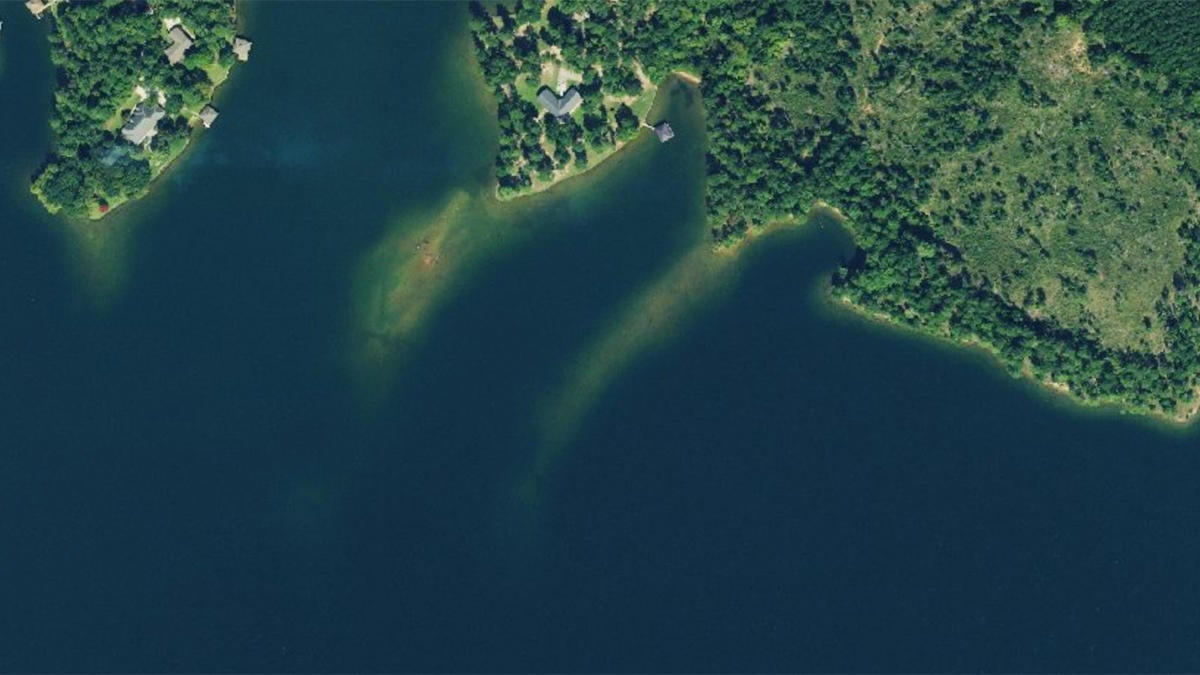
Irregularities your naked eye wouldn’t think to look for
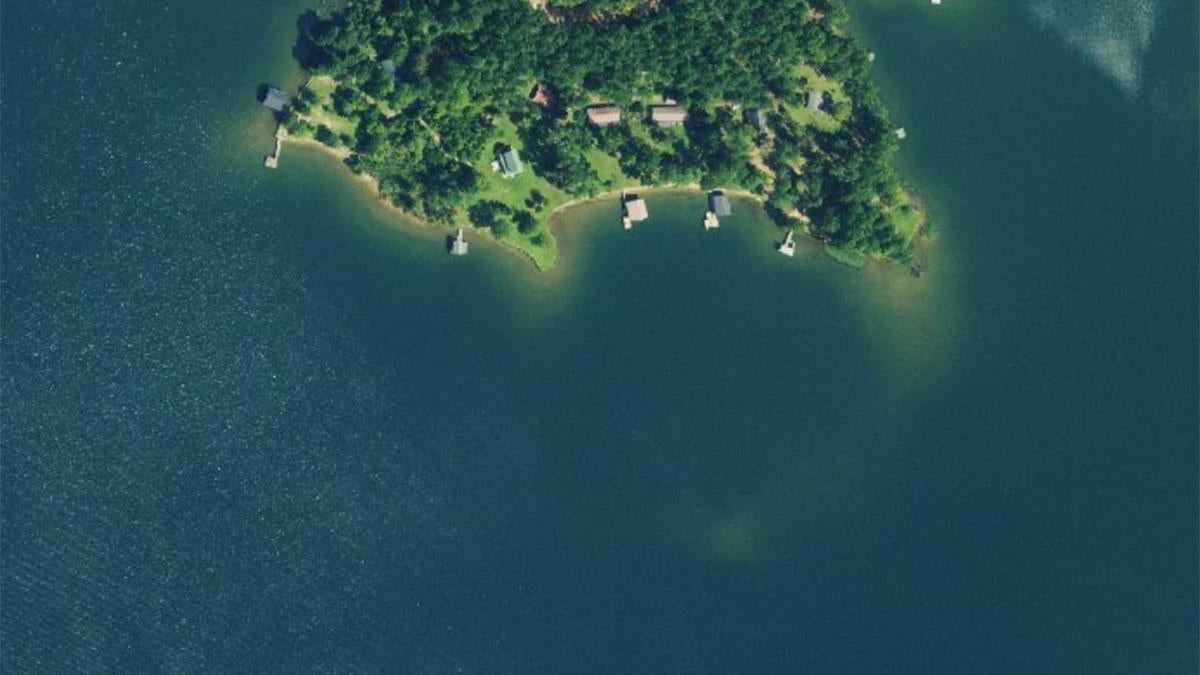
In the photo above, I always thought the far-right point continued at a roughly 45-degree angle from the bank because that’s just how I always read the topography of the land. I’m sure some of you reading this think I’m stupid for not verifying that with my boat’s electronics. Maybe I am.
But since I found this bizarre, hook-shaped shallow point using satellite imagery, I have been catching a pile of fish around it. Again, my in-boat mapping never really picked it up so most of the time, I’d just drive over it and never think twice. Every now and again, I’d pick up a Carolina rig and catch a 16-incher off of the small shallow bar I could see with my naked eye.
I never knew the structure was this prominent, though. It offers big bass an easy escape from heavy currents coming from either direction while also giving them a practical buffet as crawfish and shad mill around on top of that shallow, light-colored shelf.
I can almost guarantee you that there is a similar area on your favorite fishery if you put a little time in with satellite imagery.
Isolated humps before you get too close to ’em
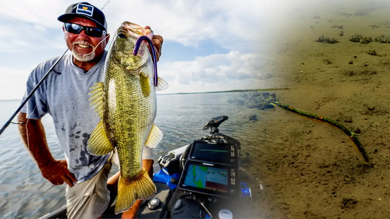
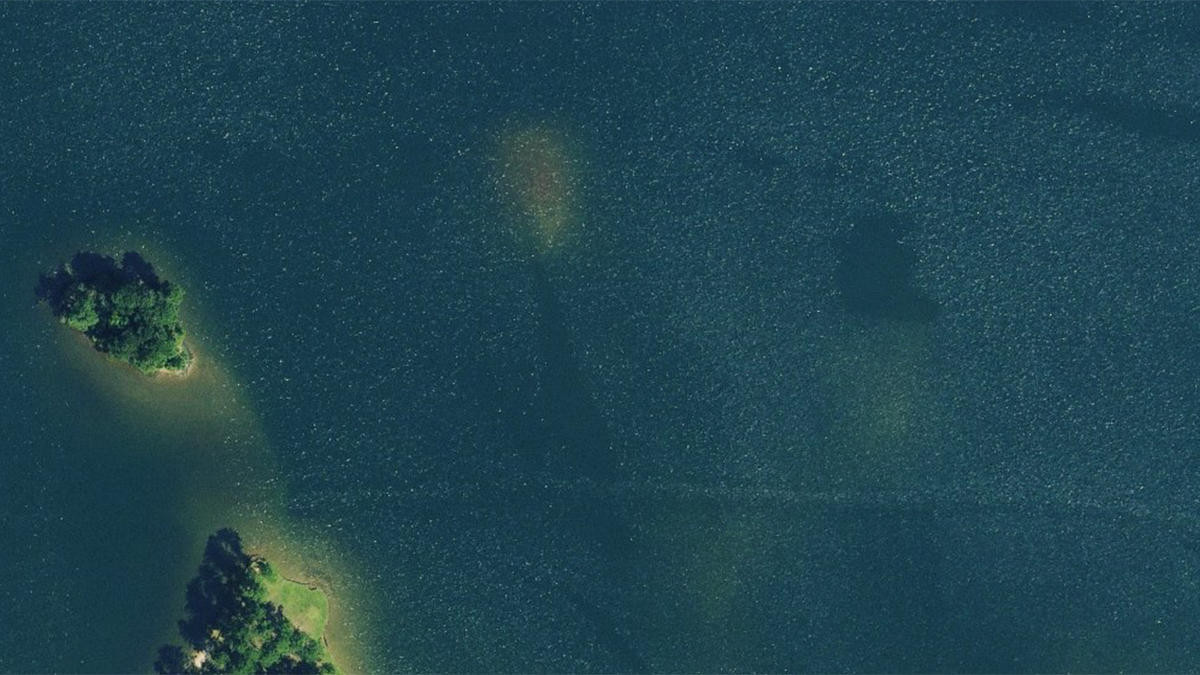
Some of the absolute biggest bass I’ve ever caught have bit while I’m cranking shallow offshore humps or shoals. My boat might be sitting in 20 feet of water but my 6-foot diving crankbait is dredging bottom in 4 feet of water. I think those big largemouth like to “own” a particular piece of cover or structure and they essentially dare something small and tasty looking to get anywhere near it.
On the water, however, it can take a really long time to find these humps and when you do run across them, you’ve probably put your boat too close to them and spooked the fish. Sure, you can make a mental note to check ’em again on your next fishing trip but what’s the fun in that? I want to find a good-looking area and catch fish off of it at the same time.
Researching this satellite imagery makes it easy to scope out some good-looking humps or shoals before your fishing trip. This allows you to have a game plan and mark ’em on your GPS system ahead of time so you know where they are and can approach them with stealth and long casts. If you want to catch your biggest fish of the year, I can’t imagine a more high-percentage strategy… in my neck of the woods, at least.
Whenever it’s miserably hot or way too cold to bass fish, I strongly encourage you to spend some time looking at satellite imagery. Like I said, my friends and I have been using onXmaps a bunch but whatever you choose is up to you. Just find some satellite shots of your favorite fisheries and I guarantee your jaw will drop. You’ll be able to spend the entire weekend exploring new bass fishing spots you previously didn’t know about.