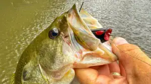
There seems to be an app for absolutely everything now. I wouldn’t be surprised if there is some widget in my house monitoring the sharpness of my kitchen knives right at this moment, just waiting for the opportunity to buzz me to put a fresh edge on them. We’ve gone a bit overboard with the apps, in my personal opinion. This overload of options has led to more confusion than clarity in many cases. However, we’re here to help make sense of the madness, in regards to the fishing apps at least. Here’s our list of the Best Fishing Apps on the market, in no particular order.
Our Top Picks: The Best Fishing Apps Available
- Deep Dive
- Navionics
- Fishing Chaos
- Omnia PRO
- FishBrain
- BassForecast
- The Weather Channel
- TVA Lake Info / Alabama Power Shorelines
- Google Earth
- Garmin Active Captain
- Trout Routes
Deep Dive

Deep Dive is like having a suite of digital fishing tools in your pocket. Many options are integrated with the most updated weather and water data, giving you more from every minute you’re fishing. It also helps to plan your trip better before you even get there.
The Bait Tool is a super simple way to find out what the top bait is for your lake. Additionally, it lets you control the in-the-weeds data input, which is paired with the weather conditions for the spot and time you’ve selected. All that info is fed into the Deep Dive top baits engine, giving you get the most accurate results possible.
The Water Clarity Map helps you strategize with frequently updated satellite imagery — a tool available for over 120 popular lakes. The Tournament Patterns Map leverages real patterns that professional anglers use to win tournaments so you can succeed like them. Tournament pattern results are relevant to your lake characteristics, pattern options you’ve set, and weather and water conditions. You can filter the map by season, fishing style, aquatic vegetation, and other factors.
The Wind Effect Map lets you easily see where wind beats the bank and creates waves, and reveals calm areas. Plus, you can see the intensity and how it is likely to change through the day. The Streamflow Map follows changing water, helping you land bigger catches and know where water flows into a lake.
And that’s not all. Deep Dive also features maps for tides and waterflow. Using real tournament data, the Best Areas Map shows the best spots to fish and the best patterns to try. Plus, the Weather for Anglers tool gives you the info you need to know as an angler right up front.
Navionics

The Navionics app is powerful, chock full of topographic maps that cover much of the globe. For North America, the yearly subscription costs $49.99 and covers the entire U.S. and Canada, inland waterways as well as coastal waters.
This app is a little pricey, but the good news is you can test it for free. If you fish from a boat and don’t have advanced electronics, it’s well worth the money. Even if you do, the Navionics app allows you to prepare for upcoming trips from the comfort of your couch.
The standard topographical maps are just the beginning when it comes to what this app can do. It has multiple overlay options, the ability to create your own charts, customize the shading of others, and more. This is one I’ve personally used a good amount over the years. It’s worth the money, in my opinion, of the angler fishing often and/or competitively from a boat or kayak.
Fishing Chaos

Next in line with apps that I have more personal experience with: the Fishing Chaos app. It is doing some really big things in the industry. I was first made aware of this app while fishing in a local tournament trail on Lake Martin, run by OGS Tournaments. For the first time, at a local pot derby, there was a live leaderboard on a big screen at the weigh-in, as well as one I could follow along with from an app on my phone. All this was made possible by Fishing Chaos.
However, what I originally thought was just an app that made LIVE leaderboards available for local derbies, I soon found to be much, much more. Fishing Chaos partners with companies, organizations and clubs to host hundreds of digital catch-photo-release tournaments throughout the year, with literally tens of thousands of dollars worth of cash and prizes up for grabs in some of them.
I went and sat down with the Fishing Chaos crew at their headquarters in Mobile, Alabama a few months ago; this is a company to keep an eye on and an app that will offer unique opportunities for anglers in the coming months and years. All this is in addition to the earth shaking innovations they have already made in the industry.
The app is free to use, with different levels of requirements/entry fees for tournaments. Fishing Chaos charges a fee to host an event. Learn more by emailing support@fishingchaos.com.
Omnia Fishing Lakes + Gear

Omnia Fishing created an app to further enhance their guided fishing experience from their website. The app offers maps, suggestions on locations, gear and more to not only show you wear to go but how to be more successful when you get there. It’s a slick app powered by Navionics Maps. It has some really cool features like notifications on things like water temperature changes and more. And you can buy the gear recommended for your location all on the app. There is a PRO offering for $59 annually that unlocks every feature while the Core level offers similar access for $39 a year, but there are some features available in the free trial version.
Fishbrain

This is an app I’ve heard a lot about, seen a ton of ads for, but don’t have any personal experience with. From what I can gather, the app has a free version as well as a paid premium version. One of the apps main functions is to crowdsource fishing locations to shorten the learning curve for anglers looking for hot fishing spots.
The critiques I’ve read of the app say that some of the users post incorrect information, with fish catch photos not matching up with scenery in the area where the catch was supposed to have taken place. This possible drawback aside, the app appears to be a very beneficial option, especially for newcomers who could use basic recommendations on where to fish and what to fish with.
FishBrain has a basic free version with a Pro version that costs $12.99/month, or half that ($6.67/month) when you pay $79.99 for the whole year.
Bassforecast

BassForecast is another app I’ve heard a lot about but haven’t personally used. It is another app that appears to be something a novice angler could benefit from tremendously. Their slogan states: “Bass science made simple”.
BassForecast uses past weather patterns as well as future weather forecasts to create a custom game plan for any angler based on where he or she is fishing. Once you enter your location the app pulls the data for that area and kicks out an overall score for how the fishing should be, as well as what techniques and baits will likely work best.
A good deal for a beginner to intermediate angler at $2.49/month, billed annually for $29.95/year.
Weather Apps

A good weather app like the Weather Channel, Windy.com or Weather Underground is absolutely essential for any angler. Many of the bass fishing apps have some sort of weather component or layer that can be used in conjunction with other features. However, a straight, stand-alone weather app is usually superior to these built-in functions.
The precipitation forecast for the day as well as the wind speed, direction and the barometric pressure all play big roles in deciding when, where and how to fish on any given day.
Apps like Bass Forecast appear to do a pretty good job of calculating a lot of this for you, especially if you’re an angler just getting into fishing. However, I like to have the added capabilities of a good weather app and then do the figuring on how the weather will affect the fishing myself.
Apps That Track Currents

If you’re a kayak angler, a big boat guy that fishes river systems or a shore fisherman who wants to know the best times to fish below dams, keeping up with the current and generation schedules is key. Current is almost always a good thing when it comes to activating fish. A sudden dispensing of current from a dam can send your kayak careening down the river, or even wash you off the shore you’re standing on. In any instance, it’s good to know what the current forecast is before you go fishing.
There are many apps out there for this purpose; a few that appear to work nationally or regionally are RiverFlows, Rivercast and RiverApp.
I don’t have any personal experience with these larger apps, but for years I have used similar information provided locally by the TVA Lake Info App (Tennessee Valley Authority) as well as Alabama Power Shorelines and their websites to track generation schedules on the Tallapoosa River, the Coosa River, the Alabama River and the Tennessee River. This information is provided for free to the public through these avenues, whereas the other apps I’ve mentioned have free and premium versions.
Google Earth

Another free-to-use, and extremely powerful, tool is Google Earth. I almost always use the detailed satellite images from Google Earth to peruse lakes and rivers before visiting them for the first time. Even on lakes I’ve been to dozens of times, I’ll still pull up Google Earth to scout new areas I haven’t fished before.
There’s a filter that will allow you to load old images, which really helps on lakes with winter pool drawdowns. If the most current image was taken when the lake was full pool, chances are one of the older images was taken with the water down. You can locate some premium fishing spots by looking for rock humps and brush piles that were visible with the water down but are now covered when the water is up.
Even if the older pictures are a decade old and you find a brush pile (one that’s likely rotted away since the image was taken), still go and take a look at it. Anglers and homeowners often replenish brush piles in the same places over and over again.
Garmin Active Captain

If you run Garmin units, the Active Captain app is one of the better fishing apps from a manufacturer. You can do a myriad of things that include controlling your devices, syncing your fish finders to your phone for recording video, and detailed map study and waypointing. The app also can handle the update process on your units, although I still prefer the download to a flash card method as its quite a bit faster and not dependent on cell and wifi.
But Jason uses the Active Captain app all the time and loves it. He will map out lakes before he travels to fish and get an idea of areas he wants to explore before he hits the water. Fishing apps that not only allow you a lot of planning opportunities but also on the water functionality are some of the best in our opinion. And it’s all free to Garmin owners.
Trout Routes

Yes this is an app designed for trout fishermen, specifically fly fishermen, but Trout Routes is incredibly handy for stream and creek fishermen too. As it can provide a ton of data to access points on rivers that also have other species beyond trout. The app covers 48 states, has 50,000 streams, 350,000 access points and 360 million acres of public land. It will rank the best streams near you and help you decide where to go and help you plan your do-it-yourself trips in great detail.
Many of the rivers provide level and flow data, access point details, and a lot more. Jason has gotten back into fly fishing over the last year and said he lives on the app planning new trips and checking out his states rivers and streams. The PRO version has a ton of information to help trout anglers but the free version is pretty valuable as well.