
Adding to an impressive collection of premium chart content and unparalleled coverage, anglers in the U.S. now can explore the detailed bottom hardness of 121 lakes with a new Sonar Imagery chart overlay from Navionics ®. Whether used on its own or combined with integrated Garmin and Navionics No. 1 mapping content1, sonar imagery provides anglers with a better understanding of lake bottom structure, helping them to discover the best potential fishing spots and improving situational awareness while on the water.
When it comes to fishing, it is a huge advantage to know the most information possible about a body of water before dropping a line. Anglers know that some species of fish prefer to hunker down in the deep, hard bottoms of the lake floor where rocks can provide excellent hiding (or hunting) spots, while others may prefer to feed from the soft-bottom muck in larger schools. Anglers can get a better idea of what bait should be used, optimal casting methods and even the best time of day to be hitting the water with information about bottom hardness.
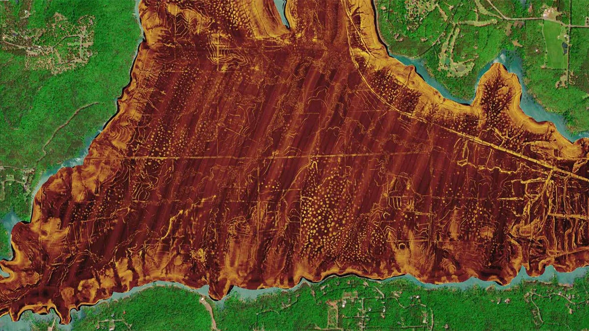
Sourced from thousands of intricate lake surveys in U.S. territory, sonar imagery reveals bottom hardness in vivid color, highlighting both subtle and dramatic transition areas. Along with additional premium chart overlays from Navionics, including high-resolution relief shading and SonarChartâ„¢ Shading with satellite imagery, sonar imagery helps anglers quickly and easily identify the most promising fishing spots on the water. This means less time searching and more time reelin’ them in.