
Mapping is a big part of fishing from a boat on larger lakes and reservoirs. Mapping options have drastically improved for popular bass fishing and other gamefish bodies of water across the country in the last 5 years and Lowrance has ramped up their custom mapping with the new Lowrance C-Map Precision Contour Maps for Lowrance fish finders.
The C-MAP Precision Contour Maps offer very defined, custom surveyed and accurately updated information for bodies of water across the country. Right now there are map cards for Tennessee, Alabama and North Carolina with more states being mapped as we speak.
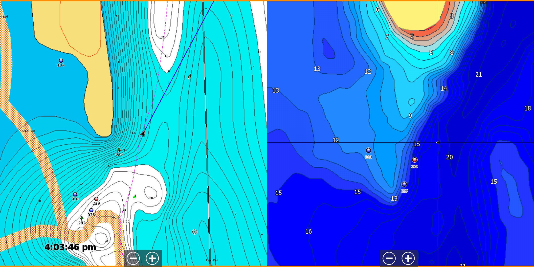
I have been using the Tennessee card to fish bodies of water like Kentucky Lake, Lake Barkley and Dale Hollow Reservoir. I have been pretty blown away about some of the spots that are detailed on this card that did not show up accurately on other maps. And how much the custom shading options have helped me rethink both my shallow and deep fishing for bass, crappie, bluegill and more on the lakes I fish.
I wanted to share some of the settings I’ve found that work for me and how I’ve been able to get the most out of these new mapping options from Lowrance.
Make Key Fishing Areas Stand Out
What I noticed right away was how easy it was to make fishing structures like humps, creek channels and long tapering points stand out. It’s also helped speed up my graphing of areas by defining more of the subtleties around an area, like a saddle on a point, a ditch on a flat, a channel swing off a tapering bank.
Show deeper creeks and shallow points better
With the custom shading, I’ve been able to make really contrasting areas stand out a lot better on the Lowrance C-MAP Precision Contour HD chips. So if I’m on a pattern where I’m looking for the most sheer drops next to the deepest water, or the last deep ditch in the back of a creek or bay, I can quickly scan a whole body of water to find two or three key places I want to fish and graph.
C-MAP Proven on Hot Fishing Spot
The biggest eye-opener for me with the Lowrance C-MAP Precision Contours was when I went over a place that I have caught fish on for years but didn’t really ever have an accurate map of the spot to look at. I had mapped it on my own by laying down waypoints on the key parts of it where the fish always got.
When I looked at it on my old map, the waypoints seemed random. But when I loaded the C-MAP card in the first time, I was amazed to see how my waypoints laid perfectly on the deep edge of the point and the flat off the side of the point unmarked on other maps.
The fish have not used this spot in years but now I can breeze over it in a few minutes and check for a school quickly. When you have 50 places like this mapped perfectly, you can fish a lot more efficiently and only spend time fishing the spots with actively feeding fish.
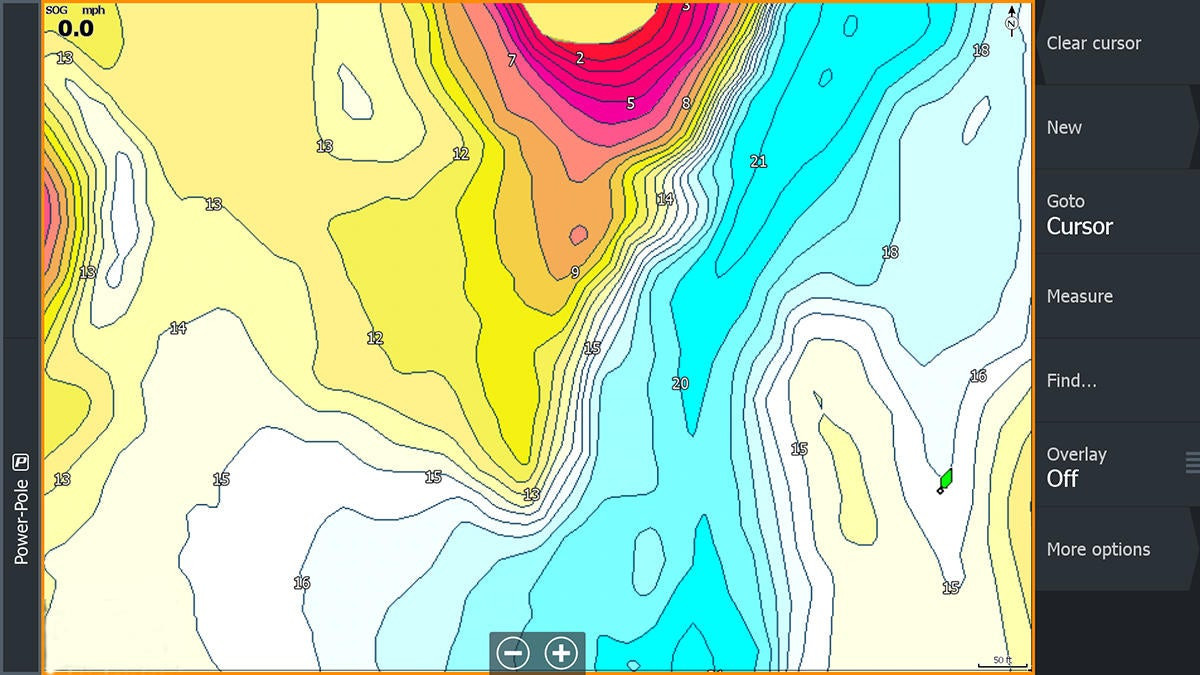
One shading option for shallow lakes
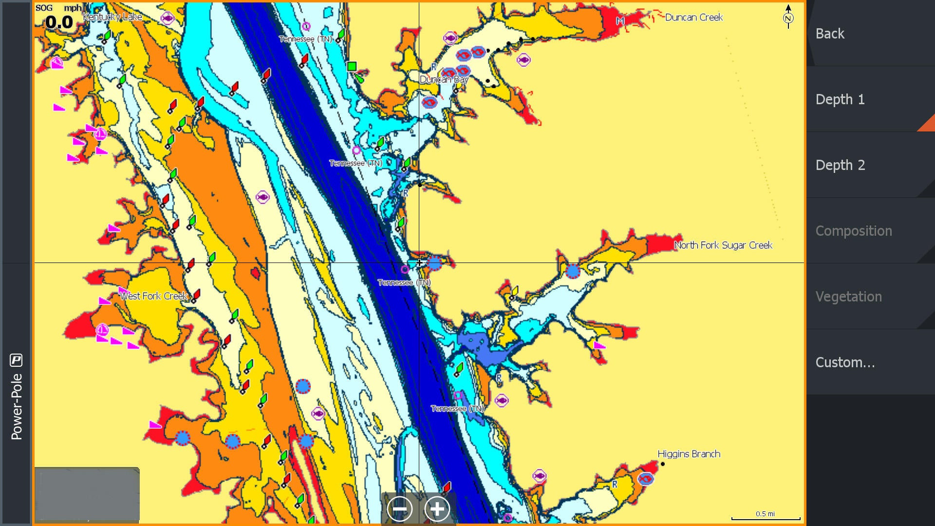
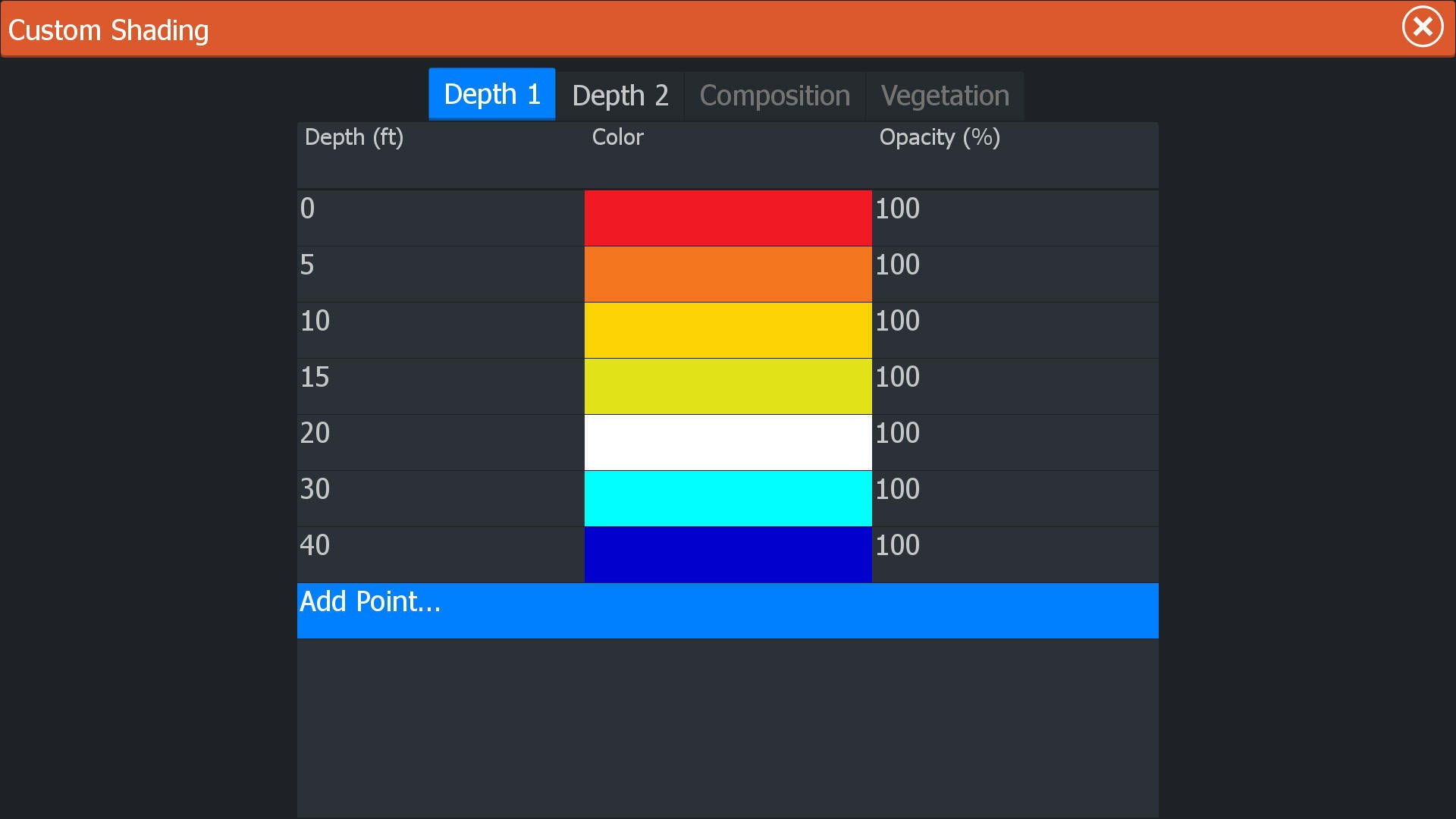
The custom shading on the Lowrance C-MAP Precision Contour HD maps make these cards invaluable to me. I’ve learned that you can custom shade two different settings with C-MAP—Depth 1 and Depth 2. I played around with a lot of different shading and color options and have settled on a couple that I really like for the different water bodies I fish.
My Custom Shading Settings for Shallower Lakes
For shallower bodies of water like on the TVA, where I will almost never look at water deeper than 25 feet, I use a shading setup that goes from red to light blue. I set up 7 different shading options of 0, 5, 10, 15, 20, 30 and 40.
The red quickly alerts me to water less than 5 feet deep which can be an issue on Kentucky and Barkley Lakes, especially at winter pool.
I set the deep water to the darkest blue largely because I use a heading arrow on my navigation chart on my Lowrance HDS Live units. That heading line is not customizable by color (something I hope will be an option in the future). So if you use the middle blue colors, you can’t see your heading line on the map.
As you can see in the previous slide, I can see shallow backs of bays, long tapering points and creek channels quickly and easily with this custom setup.
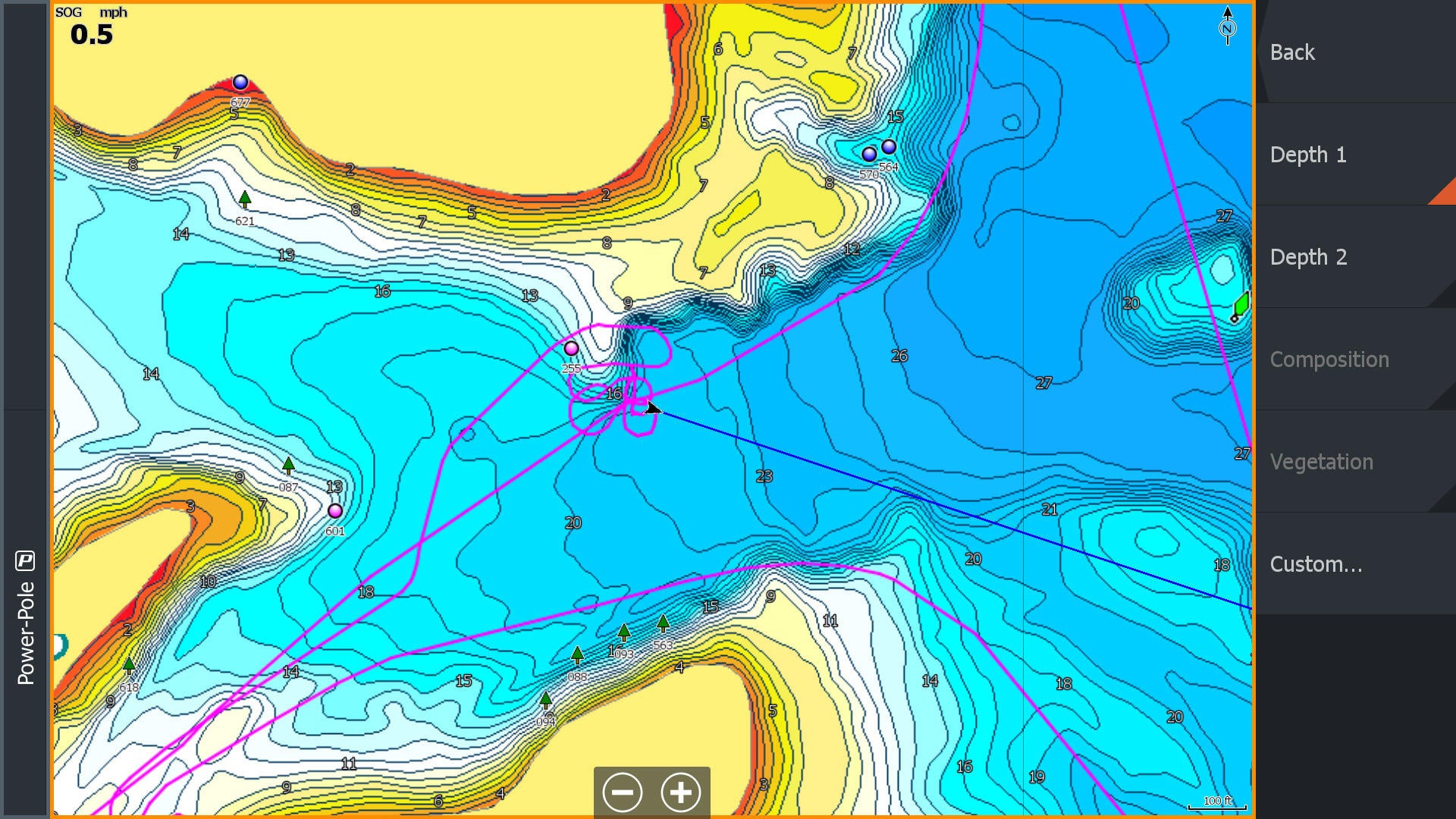
Highlight Certain Depths on Deeper Reservoirs
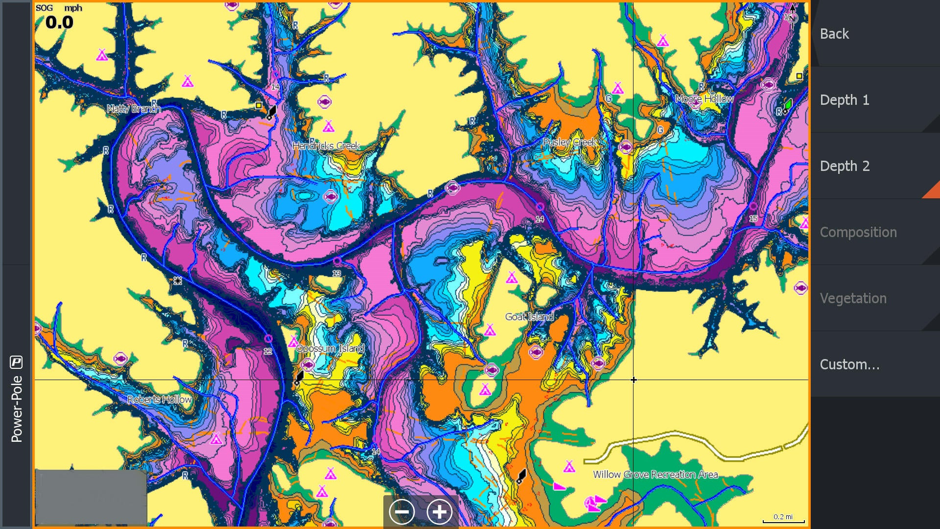
On deeper lakes like Dale Hollow where I might want to target something like deep grass, standing timber or rock piles at a depth out deep like 30 or 40 feet, I setup up Depth 2 with a completely different palette setup. I’ll show you in the next couple of slides how it makes a huge difference on these highland reservoirs where 100-foot or deeper water is common all over the lake.
But you can quickly identify shallow areas adjacent to the deep areas. On lakes that are deep where you might be focusing on standing timber, a lot of times you will look for water that is 60 or 80 feet deep because you are targeting fish in the tops of 30 or 40 foot tall trees. So I have pink highlighted in this example at 60 foot so I can see the areas I might want to scan for trees. I’m just using this as an example. But if they get Table Rock scanned like this, it would have saved me a ton of time last week.
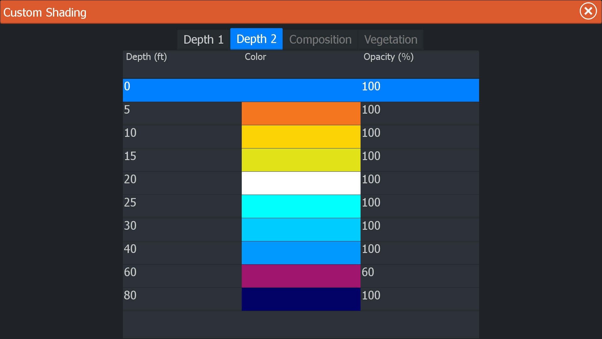
My Shading Options for Deeper Lakes
For deeper lakes where I might look for suspended fish over much deeper water or standing timber in deep water, I setup 10 intervals of 0, 5, 10, 15, 20, 25, 30, 40, 60 and 80. I put a color like pink or purple at the depth zone I want to focus on out deep and it quickly breaks the lake down for me.
Again I have found that these custom palettes make it where I have one that works really well shallow but doesn’t work as well on deeper lakes and vice versa.
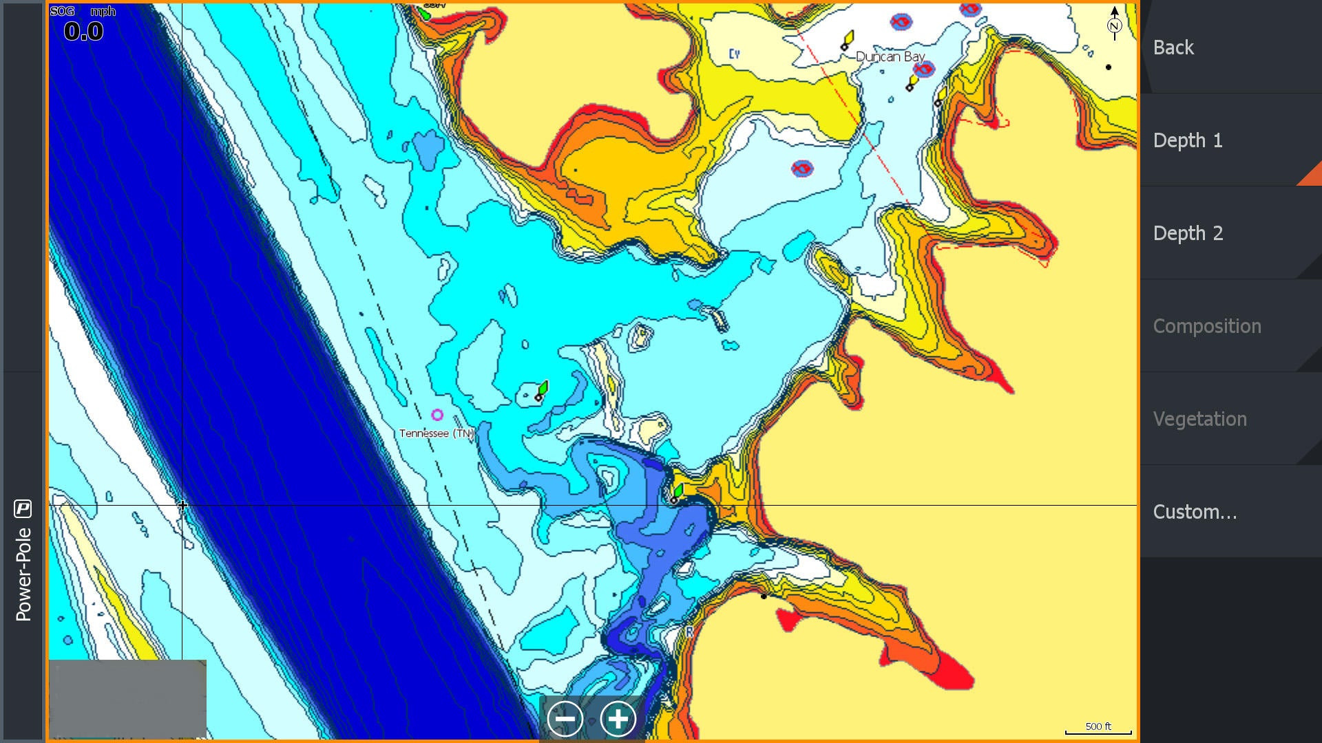
Shading Options Matter
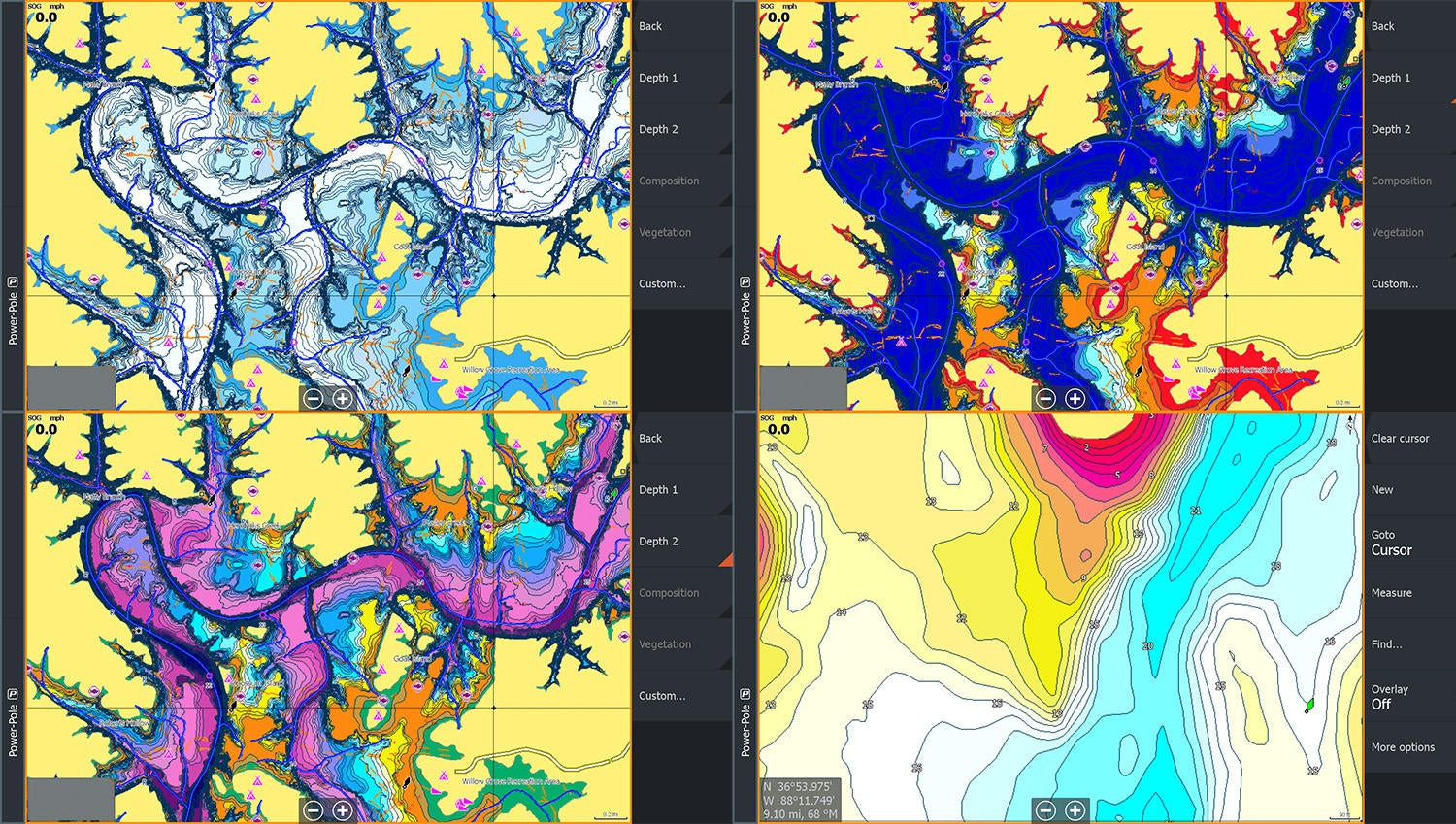
Here are some examples of how the different palettes work differently on different styles of lakes. This is an example of Lowrance C-MAP Precision Contour custom mapping at work on Dale Hollow. The custom default, then my shallow option to the top right and the custom deep option to the bottom left. I think the deep option works much better on that deep reservoir where a lot of the deep stuff is lost the way I had Depth 1 setup for a shallower lake.
While you can see at the bottom right my shallower option really breaks down a shallow point in less than 25 feet of water nicely.
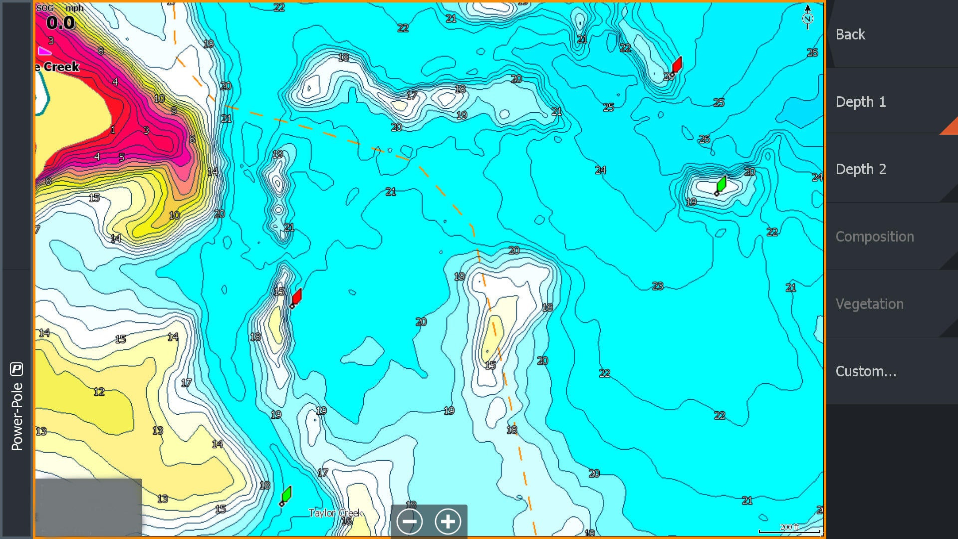
Contrasts make Subtle Areas Stand Out
The biggest thing I found was how much subtle areas showed up on the Lowrance C-MAP Precision Contour chip. Just a little deeper ditch swinging in next to a high spot, little rises that might catch a bit more current or flats adjacent to points and drops that will hold fish at key times of the year.
It has given me so much more to explore on lakes I’ve already logged thousands of hours scanning. I think that’s the biggest testament to these map cards. The 1-foot intervals, custom satellite imagery for finding things like docks and laydowns, points of interest and more help me really dive into the fisheries on these cards.
I am very happy with the Lowrance C-MAP Precision Contour Maps for Tennessee. I plan to pickup the North Carolina chip before my next trip out there and already have the Alabama chip on order. The state C-MAPs are $149 at these retailers:
Here is a great video of how Mike Iaconelli used C-MAP during the 2019 Bassmaster Classic.